Bitteswell Conservation Area
8.0 Assessment of Special Interest
8.1 Much of the special architectural interest in Bitteswell has been recognised through the Grade II* listing of the Church of St Mary and the Grade II listing awarded to 13 other heritage assets within the conservation area boundary (see Appendix A for full details).
8.2 Special interest in a conservation area is not only formed by the buildings but also the spaces between them and other features of interest. These can include the settlement layout, green infrastructure, open spaces, views and public realm. Bitteswell is a spacious open village where traditionally houses were built on spacious plots which included trees and hedging all of which contribute to the natural environment and rural character of the conservation area.
8.3 Entering the conservation area at the eastern boundary into Lutterworth Road follows the route of turnpike road and passes Tollgate Cottage (seen in historic image in Section 7).
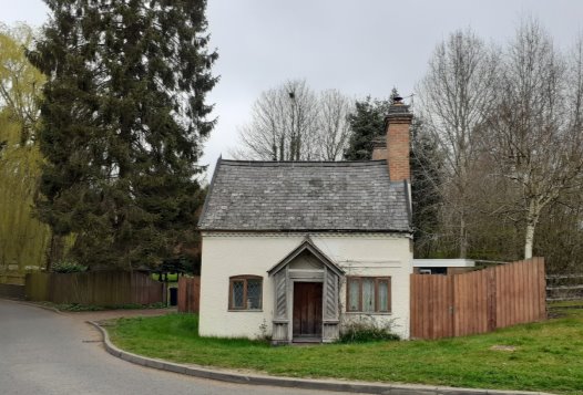
Tollgate Cottage on the corner Lutterwoth Road at the Conservation Area Boundary.
Enclosure of the farmed landscape in 1787 transformed this route into the village. Not only did the road get 'the luxury of a well-kept raised footpath' but it was noted in 1848 that, 'since the village has become well wooded with hedge-row timber and plantations, - intermixed with roofs and gables of houses, barns and cottages scattered amongst them, - the spire in the midst peering over all, the approach is extremely pleasing.'[5] Leaving the urban environment of Bill Crane Way, passing Tollgate Cottage and heading into Bitteswell along Lutterworth Road, it is still possible to experience the mix of natural and built environment of the village described in 1848. To the east are the pastures which form a foreground to the village core and contribute to the tranquil rural character of the conservation area. Glimpses of the church spire can be still seen at points throughout the conservation area.
8.4 The road to the right is The Nook. This contains development around the east of St Mary's church which links to Reverend Powell and the Twinning family. On the corner is Deanston House. This was originally built as the vicarage in 1720. Offices were added in 1789 and Reverend Powell enlarged and laid out the garden and erected brick boundary walls. This property remained in use as the vicarage until the mid-twentieth century when a new vicarage was built at the end of the garden.
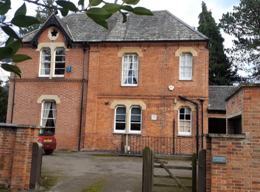
Deanston House
8.5 Next to Deanston House Reverend Powell built The Lodge in 1834 as a home for his daughter. The property was occupied by various members of the Twining family until 1906. The 1919 sales particulars for the stuccoed brick Lodge described it as a desirable freehold residential property or hunting lodge with a stone-built entrance lodge. Today these properties are the separate dwellings of the Gate House and the Hunting Box in the Nook.
8.6 These sales particulars included an image looking down the Nook towards two cottages which today form the Grade II listed Russett Cottage.
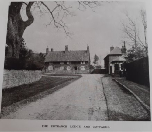
1919 Image showing the Gate House to the Lodge and two cottages in the Nook.
The sale also included 4 cottages on Manor Road (now 2, 3 and 4) and three cottages overlooking the church (1-2 and 3 Church View Cottage). Next to 4 Manor Road is the Village Hall, this was built in the late nineteenth century as The Church Reading Room. It became the Village Hall in 1976.
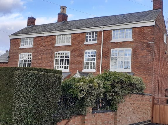
8.7 Manor Road contains a number of buildings that historically link to the small enterprises of the village. On the corner of Manor Road is the white rendered Cedar Cottage, which has a decorative chimney. Until 1862 this was the Plough Inn but has been a private residence since then. Opposite Cedar Cottage is red brick Clifton House which was originally a slaughter house and butchers shop. Until 1997 it was also the village post office and the George V pillar box in the wall is an attractive feature of the conservation area. Also located in Manor Road is Tithe Cottage which was originally a stable with sluices used by stage coach horses during the eighteenth century. Next to this is the old bakery although there have been millers and bakers in the village since the 1600s the house dates from the early 1900s when the original was burnt down.
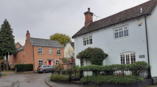
View into Manor Road with Cedar Cottage on the right and The Old Bakery in the distance.
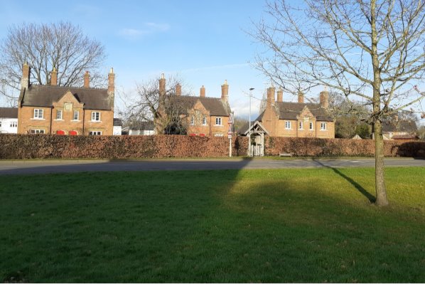
8.8 From the crossroads at the centre of the village greens the mixture of building styles and materials is evident as is the open spaciousness of the village. With no dominant architectural style, it is possible to see the historic development of the settlement. There is an attractive grouping of buildings around The Green's edge, 9 of which are nationally listed at Grade II (see Appendix A).
8.9 Next to St Mary's Church is a terrace of simpler eighteenth-century buildings comprising the original 4 messuages of 'The Chestnuts'. The horse chestnut tree and St Mary's Church with its lychgate make a fine closure to the eastern end of the greens.
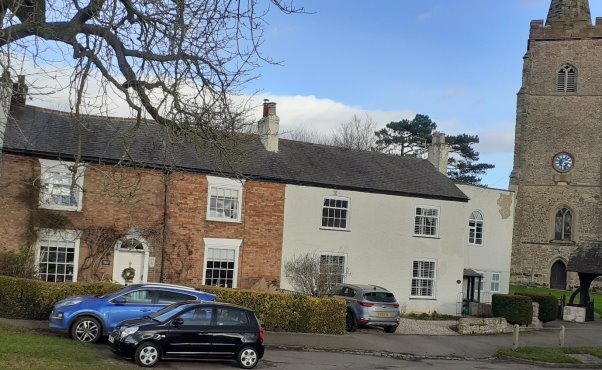
Further along the row and into Ashby Road are Tilt House which was originally built in 1721 but has been altered over the years. It is reported that bricks from the old Bitteswell Hall, demolished in 1928, were used in the construction of the garage and outbuildings in the 1930s. Next to this is the Georgian brick-built Newstead House which is a prominent feature on the bend as Ashby Road reaches The Green.
Newstead House
8.10 The Grade II listed Almshouses of Powel Row form a striking centre piece to the village. The three sets of semi-detached cottages are set in spacious gardens on The Green. This allows for views through from the village greens to the properties behind and provides a good example of the relationship between the built and natural environment of the conservation area.
Cottages of Powell Row with glimpses of properties in the West End seen between the cottages.
8.11 Across the Green from the Almshouses is the Man at Arms public house. Designed in the 1930s with a mansard roof and located between two of the oldest buildings on The Green (Dunlis House and Turnpike Lodge) this building makes a positive contribution to the conservation area. The 1887 map of Bitteswell (see section 7) shows a public house on this site. It had previously been known as the Fleur-de-Lis and the New Royal Oak. When the building re-modelled in the twentieth century it was re-named the Man at Arms. The choice of name links to a charitable donation to the parish from Robert Dowse in 1534. One third of the monies was allocated to supplying one armoured man when the King was at war and the payment was still made during the First World War.
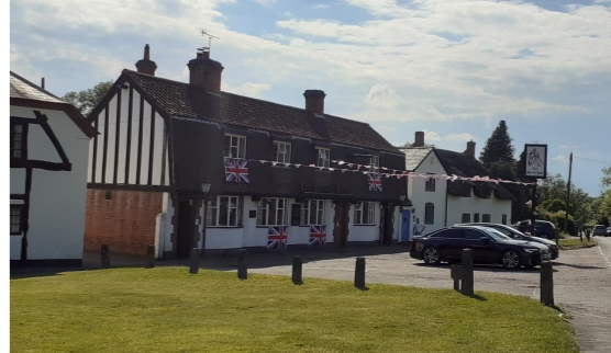
The Man at Arms located between Dunlis House and Turnpike Lodge – decorated to celebrate the Platinum Jubilee of Queen Elizabeth II in 2022.
8.12 Westfield is another early twentieth century addition to the conservation area that makes a positive contribution to it and shows the development of the settlement. Set in a mature garden this property marks the western end of the conservation area on Ullesthorpe Road. There are late twentieth and early twenty-first century buildings on the other side of Ullesthorpe Road opposite Westfield. These properties are more suburban in character and are in closer proximity to each other, unlike the space surrounding Westfield or the Powell Row cottages however, they do not detract from the quality of the conservation area.
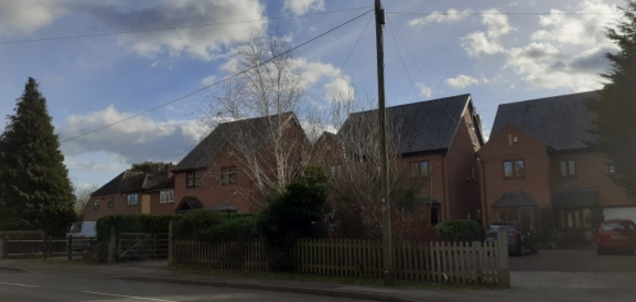
The suburban character of properties on the south of Ullesthorpe Road
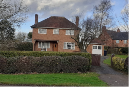
The more spacious setting of Westfield on the other side of Ullesthorpe Road.
8.13 Valley Lane is the remaining road to lead off the central crossroads on The Green. This long cul-de-sac which includes the village school, the early nineteenth-century Grade II listed Royal Oak pub and Dowell House (formerly Valley Farmhouse). The 1887 map (see section 7) shows Bitteswell House (1800) to be the last property in the cul-de-sac before it peters into a footpath leading to open countryside. For over a century Bitteswell House sat at the far end of Valley Lane overlooking open countryside.
Bitteswell House
In the last decades of the twentieth century new properties were built in Valley Lane. The additions to Valley Lane in the last forty years have generally been of higher density and more suburban in character, however, the quality of the lane remains. There are two footpaths leading directly from Valley Lane into surrounding open countryside within and outside the conservation area boundary. The image below is from the footpath just before Bitteswell House which demonstrates that although housing density in Valley Lane has increased its rural setting within the conservation area has remained.
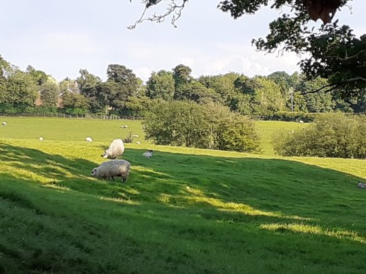
View from the footpath on Valley Lane looking east over the open countryside of the conservation area.
[5] E. Bottrill and Son, A Reply to the Question (if it should ever be asked) 'Where and What is Bitteswell?' 1848, p.9.